Projects

Data visualization basics with R
Tutorials aimed at beginning R learners. Presentation for Twin Cities R Users' Group.
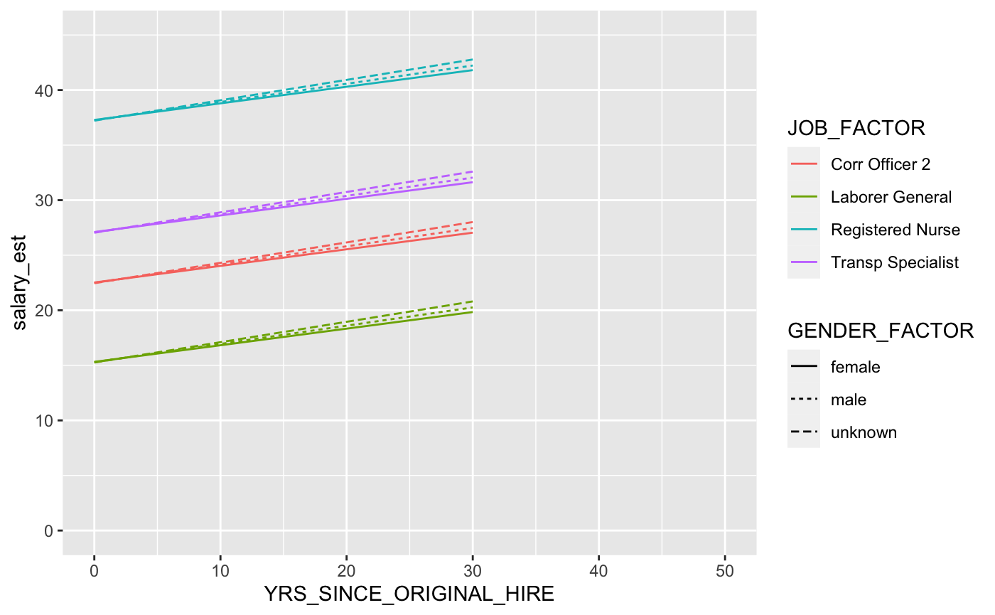
Multilevel modeling with Minnesota public salaries data
Presentation for Twin Cities R-Ladies
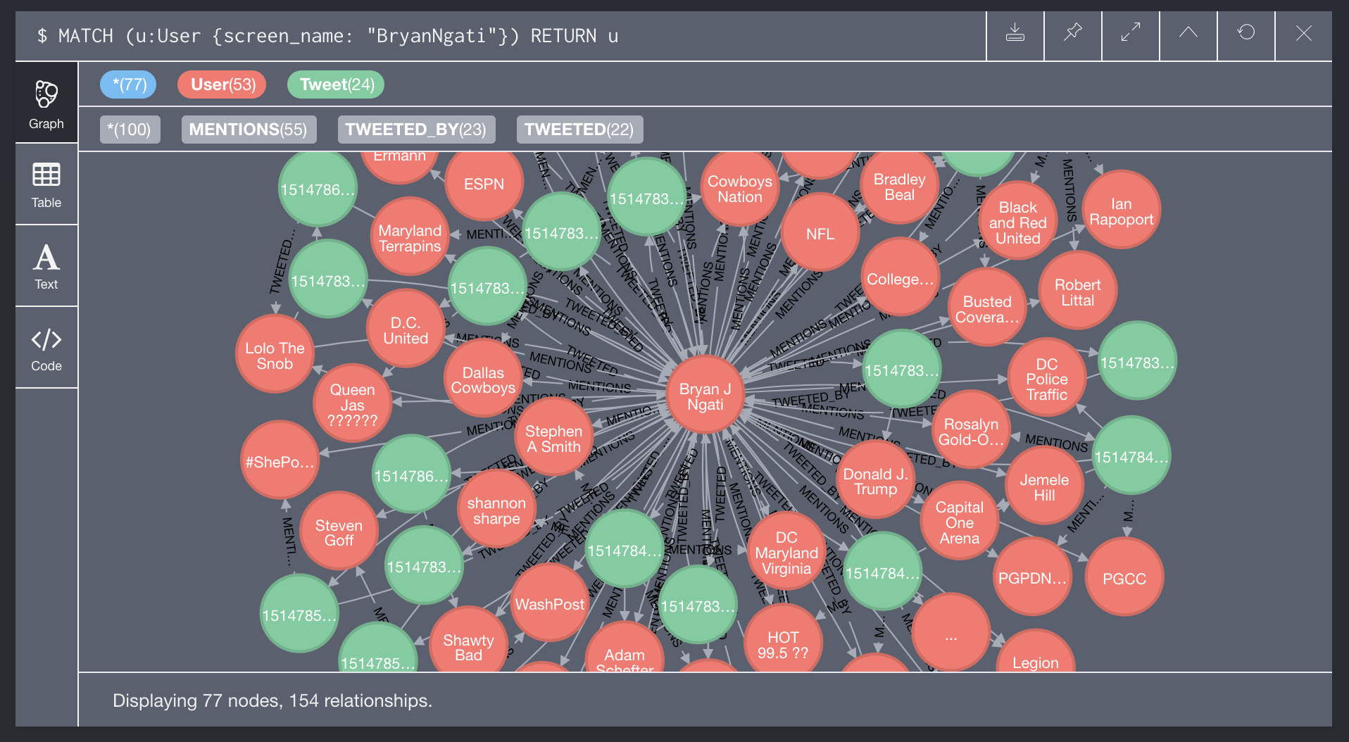
NoSQL databases for spatial analysis
Introductory tutorials exploring the spatial featuresets of some popular NoSQL databases (MongoDB, Neo4j, Elasticsearch)
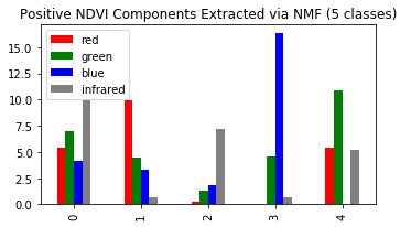
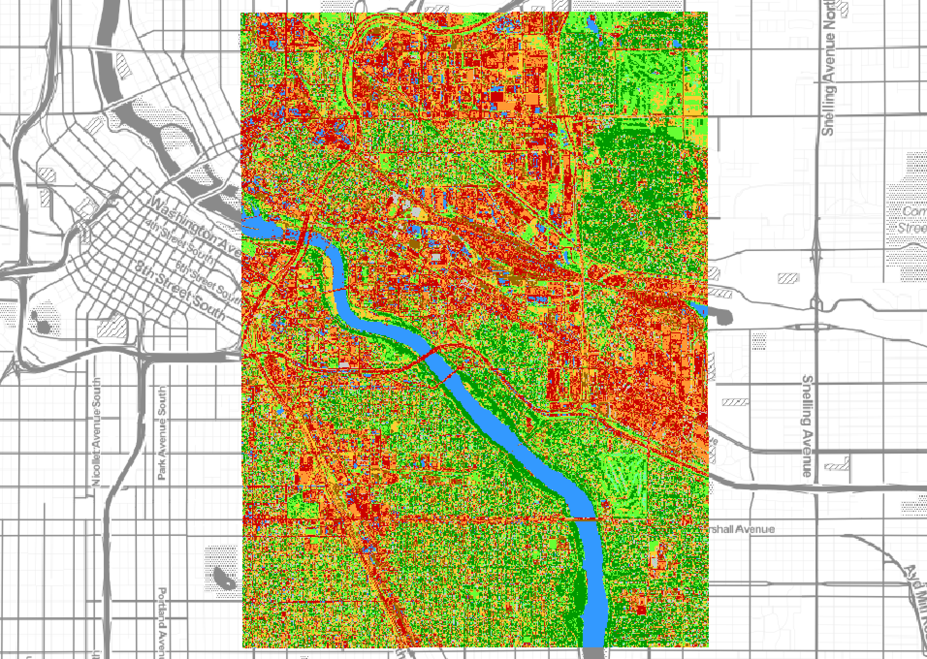
Unsupervised aerial image classification using non-negative matrix factorization
Explore non-negative matrix factorization (NMF) as an unsupervised algorithmic approach to landcover classification in NAIP imagery
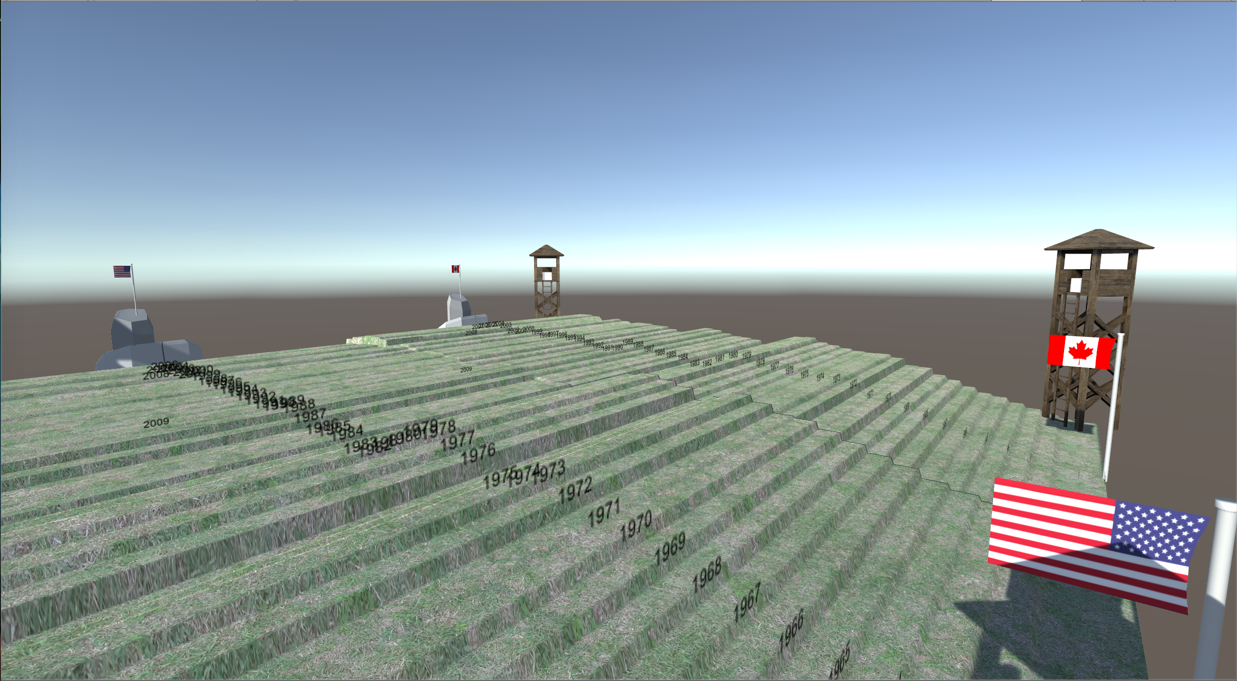
Take a walk around your data: Visualizing spatialized data in Unity 3D
Use Unity 3D game development engine and Python scripting to transform non-spatial data into a "spatialized" interactive 3D visualization
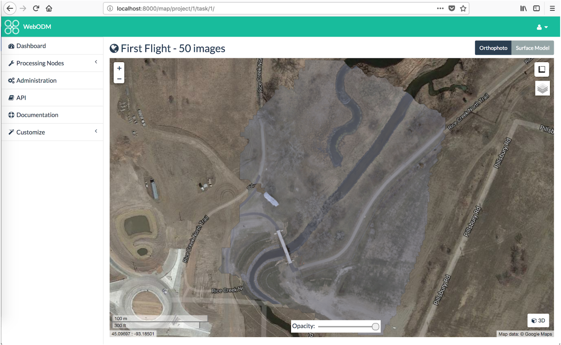
Desktop, cloud, or open source?: Comparison of UAS imagery processing tools
Group project that involved conducting UAS data collection at a site in the Twin Cities metro area and using this data to explore a range of emerging aerial imagery processing tools/services. Poster presented at 2018 MN GIS/LIS Conference, Duluth, MN.
Decoding the database: A critical analysis of open source GIS tools for humanistic mapping
Presentation for the 2016 Digital Humanities Forum, Lawrence, KS
Paint by numbers with NAIP
Train a supervised classifier to detect landcover classification in NAIP imagery using OrfeoToolbox and QGIS Python scripting
Social network analysis in R
Presentation for Twin Cities R Users' Group
Minding the gaps: Mobile technologies and student perceptions of technology
Article based on research conducted with first-year student iPad project at the UMN College of Education and Human Development

Vision and action: A three-year retrospective on a large-scale mobile initiative
Presentation at the 2014 EDUCAUSE Learning Initiative Annual Meeting